Itineraries
From easy day runs exploring the hills, to consecutive days at high altitude, we can find the perfect trails to match your ambition

Below are a selection of sample itineraries to give you a sense of what the area has to offer. These can be easily adapted to suit your particular interests or training needs, varying the location and distances of runs, or interspersing run days with rest days, or dynamic rest days such as hiking.
Holidays can range from a day, to a week, or longer, and be based in a single location or move about to explore everything the area has to offer. If you're looking for something and can't see it below, get in touch and let us design the perfect running holiday for you based on your exact specifications.
If you're happy following a watch or GPS device, we can also provided you with GPX routes for self-guided days.

Granada
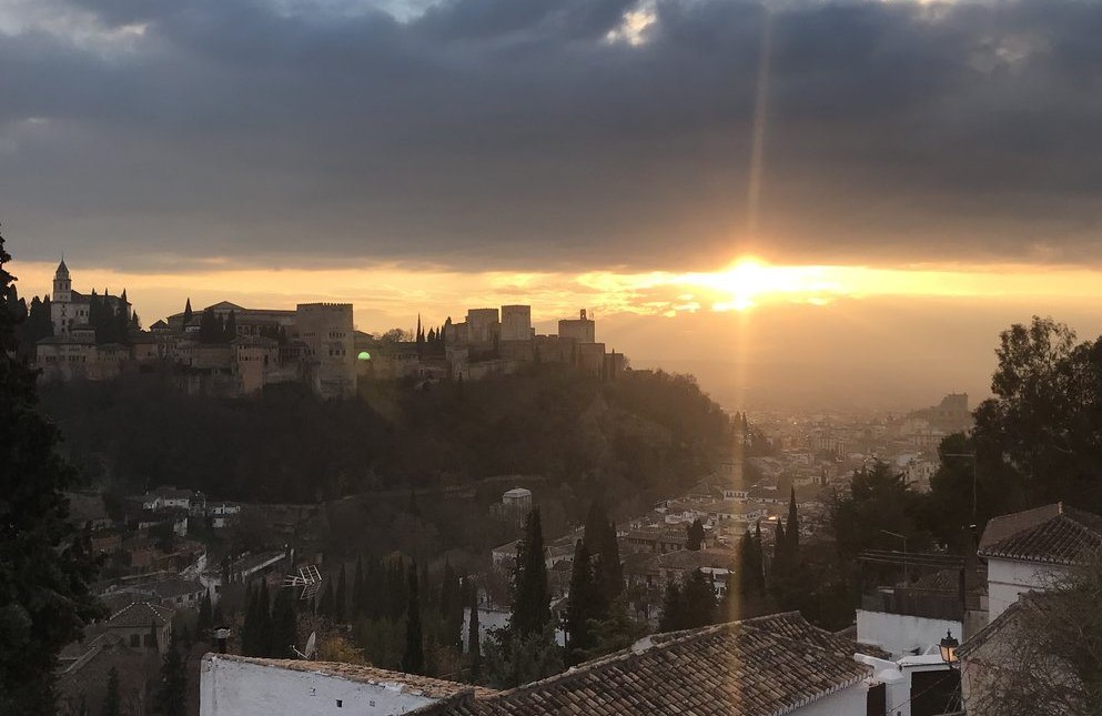
One of the most beautiful cities in Andalucía (if not Spain) Granada is a city of spectacular Moorish buildings, passionate flamenco and appetising tapas, all set within the foothills of the Sierra Nevada. Our Granada package begins with a running tour of the city to point out some of the major places of interest, before heading out to the surrounding countryside and hills.
- Day 1: Afternoon running tour of the city of Granada. Approx. 8km/5miles, 300m ascent/decent.
- Day 2: A long run from the heart of Granada, past the Alhambra palace and out into the surrounding hills. Approx. 22km/14miles, 800m ascent/descent, max elevation 1,122m.
- Day 3: Option 1 - A loop run in the beautiful Cumbres Verdes (‘Green Peaks’) mountains, less than half an hour from Granada. Approx. 12km/7.5miles, 500m ascent/descent, max elevation 1,745m. Option 2 – A second route option in the Cumbres Verdes, with more climbing, and which includes summiting Trevenque. Approx. 17km/10.5miles, 1,110m ascent/descent, max elevation 2,079m (Tevenque summit).

Lanjarón
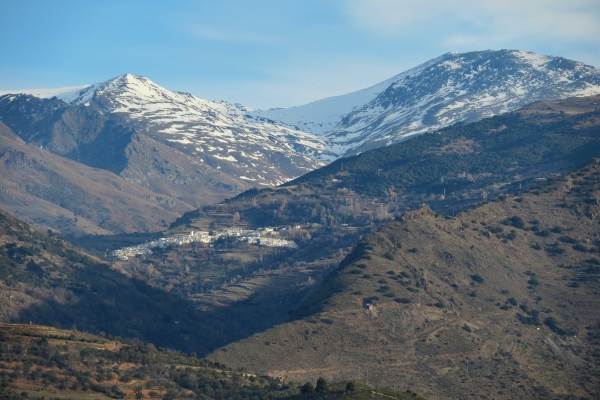
Less than an hour from Granada lies the town of Lanjarón. Known as the gateway to the Alpujarra (‘La puerta de la Alpujarra’) and famed for its pure spring water, clean air and natural environment, the town is ideally suited to scenic trail runs. Numerous bars, restaurants and shops provide ample opportunity for experiencing local food and relaxing après-run.
- Day 1: Arrival in Lanjarón. Afternoon looped run, to give you an overview of the town, its setting, and the surrounding countryside. Approx. 10km/6miles, 670m ascent/descent, max elevation 1,095m.
- Day 2: Option 1 - A longer run up into the hills from Lanjarón, featuring beautiful views and challenging climbs. This route takes in several interesting features revealing details about the rural culture and agricultural history of Lanjarón and the Alpujarras, as well as following ancient acequias (Moorish water channels). Approx. 14km/8.5miles, 1,135m ascent/descent, max elevation 1,476m. Option 2 – An extended trail taking you further up into the hills behind Lanjarón, where golden eagles and ibex are often seen in their mountainous terrain. Approx. 21km/13miles, 1,210m ascent/descent, max elevation 1,644m.
- Day 3: A point-to-point run along the long distance GR7 path, through spectacular scenery and passing several picturesque mountain villages. Either catch the bus to Capileira and run back to Lanjarón for a majority descent, or run up to Capileira and return by bus for another day of strong climbing. Approx. 20km/13miles, 822m ascent, 1,687m descent (Capileira – Lanjarón), max elevation 1,535m.

Capileira
Capileira is the highest of the three white villages of the Poqueira gorge and at 1,450m (higher than Ben Nevis – 1,345m) is the perfect base for high altitude runs and trails into the high peaks of the Sierra Nevada. The town itself is beautiful and charming, and affords inspiring views down the Poqueira valley. The variety of trails from the village make this the ideal spot for longer stay trail running holidays.
- Day 1: Arrival and short run from the village along the Poqueira gorge. Given the altitude of the town, this provides a useful acclimatisation opportunity and will help prepare for the days ahead. Approx. 9km/5.5miles, 680m ascent/descent, max elevation 1,560m.
- Day 2: Option 1 – Ascent of Mulhacén, the highest mountain on the Iberian peninsular. A tough day of extensive climbing and high altitudes, but worth it for the sense of accomplishment and incredible views from the summit. Approx. 28km/17miles, 2,290m ascent/descent, max elevation 3,482m (Mulhacén summit). Option 2 – A point-to-point mountain trail run to the town of Trevélez experiencing the wilderness of the high Sierra. On clear days, you can glimpse the coast of Africa across the Mediterranean sea. Approx. 21km/13miles. 1,218m ascent, 1,300m descent, max elevation 2,242m.
- Day 3: Option 1 – A looped run to the Poqueira mountain refuge, running along the ancient acequia water channels and through the Poqueira gorge, along the river Naute. Approx. 19km/12miles, 1,410m ascent/descent, max elevation 2,475m. Option 2 – A point-to-point run along the long distance GR7 path, through spectacular scenery and passing several picturesque mountain villages. Either run down to Lanjarón and return to Capileira by bus for a majority descent, or catch the bus to Lanjarón and run back for a day of climbing. Approx. 20km/13miles, 822m ascent, 1,687m descent (Capileira – Lanjarón), max elevation 1,535m.


